English
Every day we offer FREE licensed software you’d have to buy otherwise.
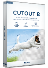
CutOut 8 (Win&Mac)
April 24, 2024
Cut out images perfectly, mount them neatly, and remove distracting elements!
Game Giveaway of the Day
Or use a chatbot
iPhone app giveaways »
$0.99 ➞ free today
For those of us who can appreciate weird and funny drawings, these stickers can’t fail to fascinate.
$0.99 ➞ free today
enhanceAI will vastly improve less-than-ideal images and add incredible detail with our optional Super Resolution.
$2.99 ➞ free today
$1.99 ➞ free today
Android app giveaways »
The global bass booster and the equalizer enhances the sound quality of your Android device.
$1.99 ➞ free today
Want to get experience and emotion from driving a real city train in the metro simulator?
$0.99 ➞ free today
An alien ship has taken possession of multiple cities on planet earth, deploying countless robots.
$2.99 ➞ free today
If your device has low sound, use Volume Booster and Sound Amplifier to make your device super loud.
$1.99 ➞ free today
Top Giveaways »
 vTubeGo Video Downloader 2.0.8
Download videos from all trending video & music streaming sites and platforms!

GIVEAWAY download basket
Developed by Blender Team
Developed by FastStone Soft
Developed by OlyKit, Inc.
Developed by Internet Download Manager, Tonec Inc.
Developed by TeamViewer GmbH
Developed by Audacity Team